|
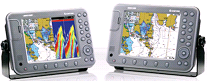
Adoption of 10.4TFT LCD color display enables better resolution.
WGS-84 geodetic system automatically enables all the geodetic lines to automatically convert.
Smooth conversion to other displays prevents the map from disappearing while ZOOM IN/OUT.
C-MAP NT MAXTM available.
Combination with SAMYUNG autopilot system offers perfect autopiloting.
Latest electronic chart with wide range of updated technology offering a variety of information such as slime, rock, depth, trench,
EEZ line, underwater cable line and the like.
Straight pursuit and ZOOM IN/OUT enabling users to make exact calculation of fish group at the sea bottom (NAVIS 5100F)
Use of 2(two) frequencies in common offering better judgment on minute fish groups.(NAVIS 5100F)
|